
The ISPRS International Conference on Geo-Informatics Supported Disaster Risk Reduction & Smarter Urban Management (Gi4DM 2022 & Urban Geoinformatics 2022) was held from November 1 to November 3 in Beijing. The conference was hosted by the Beijing University of Civil Engineering and Architecture (BUCEA), and supported by the Chinese Society for Geodesy Photogrammetry and Cartography (CSGPC), China Association for Geospatial Industry and Sciences (CAGIS), GNSS & LBS Association of China (GLAC), China Centre for International Science and Technology Exchange (CISTE), Beijing International Science and Technology Exchange Center (BISTEC), International Science Council GeoUnions Standing Committee on Disaster Risk Reduction (ISC-GU-SC-DRR), United Nations Committee of Experts on Global Geospatial Information Management (UN-GGIM) Academic Network, National Earth Observation Data Center (NODA), Key Laboratory of Urban Spatial Information, Ministry of Natural Resources of the People’s Republic of China, China Urban Infrastructure Chamber of Commerce New Infrastructure Branch, and ZGC Geospatial Information and Technology Alliance (ZGITA). PIESAT Information Technology Co., Ltd. sponsored the conference.


The conference focused on the two topics of “Disaster Risk Reduction” and “Urban Management”.
At present, countries around the world are deeply afflicted by natural disasters such as earthquakes, landslides, floods, freezing, forest fires, etc., especially COVID-19 which has ravaged the world since 2020 and brought new challenges to emergency disaster reduction. As a result, it is urgent for academic circles to discuss new strategies, methods, and technologies to better cope with all kinds of disasters. Since 2005, ISPRS has organized 13 consecutive “International Conferences on Geo-Information for Disaster Management (Gi4DM)” around the world. This 14th Gi4DM 2022 is the second conference to be held in China after Gi4DM 2008 held in Harbin in 2008.
Urban areas are densely populated and economically active, with developed infrastructure, which is facing enormous pressure in need of scientific planning and sustainable development. Remote sensing and geo-information technology can effectively support the deep understanding, scientific planning, effective monitoring, and fine management of urban resources and activities. This conference focused on Urban Geoinformatics to discuss and exchange ideas on the frontier theory, technology, and application of the development of remote sensing and geo-information technology in the urban environment.
The conference was held both online and offline. More than 200 experts, scholars, and students from 11 countries and regions including China, Turkey, Germany, Australia, Canada, Netherlands, New Zealand, Italy, the Philippines, Serbia, and Japan attended the conference.
At the opening ceremony, Mr. SONG Chaozhi, President of CSGPC, expressed warm congratulations on the convening of the conference on behalf of CSGPC. Professor LI Aiqun, Vice President of BUCEA, briefly introduced BUCEA’s development history and school-running characteristics. He also expressed the hope that by organizing this conference, an international science and technology exchange platform would be set up, where the advanced experience and latest achievements in the development and application of related technologies at home and abroad would be collected, promoting extensive cooperation with complementarity in advantages.
Besides, Professor JIANG Jie, Secretary General of ISPRS, introduced in detail the development history, working purpose, organizational structure, and key work plan of ISPRS during her term from 2022 to 2026, as well as the ways and means for Chinese scientific and technical personnel to participate in ISPRS activities.
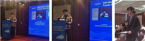
After the opening ceremony, three plenary sessions were held, in which nine experts active in scientific research and application in this field were invited to give keynote reports. The substantial and wonderful reports provided a high-end academic feast for the audience.

The conference received 108 full texts or abstracts submitted by authors, with 40 full-text review papers and 33 abstract review papers accepted after review. The papers were to be published in ISPRS Annals of the Photogrammetry, Remote Sensing and Spatial Information Sciences (ISPRS Annals) and The International Archives of the Photogrammetry, Remote Sensing and Spatial Information Sciences (ISPRS Archives). The conference arranged four Gi4DM sessions (24 oral presentations) and five Urban Geo-Info sessions (30 oral presentations).
The speakers presented the latest research findings, shared the successful experience, and discussed the related academic and technological development trends. During the presentation, many audiences actively raised questions and discussed, enjoying a warm atmosphere.
In cooperation with relevant academic organizations and scientific research institutions, the conference organized three special sessions. Among them, the “Open Science Approaches for DRR” jointly initiated and organized by ISC-GU-SC-DRR and NODA, invited project directors, experts, and scholars from IRDR (Integrated Research on Disaster Risk) of International Science Council and Committee on Data for Science and Technology (CODATA), International Knowledge Centre for Engineering Sciences and Technology (IKCEST) under the Auspices of UNESCO, United Nations Office for Disaster Risk Reduction (UNDRR), as well as young scientists and more than 30 doctoral and master’s students from Zhejiang University, Shandong University of Science and Technology, Japan’s Institute of Physical and Chemical Research. They exchanged views on the needs, methods, technologies, policies, and products of open science, and discussed the jointly prepared draft of the Policy Brief on “Approaches and Challenges: Open Science for DRR”.
The “One-stop Remote Sensing Big Data Online Services” session was jointly initiated and organized by PIESAT Information Technology Co., Ltd., Capital Normal University (CNU), and BUCEA. It introduced the R&D and application progress of the one-stop remote sensing big data online analysis platform, Wukong cloud platform, and online surveying and mapping technology training platform for earth observation, and showed the online application cases of remote sensing data based on PIE-Engine.
The “Ecological Environment Monitoring to Urban Areas along China-Europe Railway” session was jointly initiated and organized by BUCEA and the University of Novi Sad, Serbia. Based on the China-CEEC Joint Education Project of “AI-Based Remote Sensing Monitoring of Urban Ecological Environment along the China-Europe Railway Express”, the two sides exchanged and displayed the research progress, and invited experts from Wuhan University and Aerospace Information Research Institute, Chinese Academy of Sciences to introduce the research methods and progress of long-lived, large-scale remote sensing interpretation products and global high-frequency vegetation cover data products.
